


 52 / 87

June 2017
52
Find Us On Facebook at Boating On The Hudson
and drops dramatically over a dam before heading out to the
Saugerties Lighthouse (Boating On the Hudson & Beyond,
June 2015) and The River.
The source of the 63.3-mile Rondout is, interestingly, only about
3½miles southeast of the source of the Esopus, at an elevation of
2,980 feet, between 3,508-foot Rocky and 3,623-foot BalsamCap.
The Rondout initially heads south to Peekamoose, then swings
southwest down to the Rondout Reservoir, then southeast to
the Napanoch/Warwarsing area before a long trek northeast,
finally dropping over a low, wide dam, and meandering out to
the Hudson between Kingston and Port Ewen (Boating On the
Hudson & Beyond, June 2016).
We’ve spent a lot of time lately canoeing on the Hudson’s
creeks, marshes, and small rivers . To me, the real beauty of
these waters—besides the scenery, solitude, and silence—is
that they are virtually unreachable by any means except small
“human-powered” craft: many of the places we’ve reached, and
the route we’ve used to get there, are impossible to reach by any
other means—walking, hiking, car, ATV, motor boat, whatever,
except maybe by helicopter. But that would be a LOT noisier,
and, expensive...
In our experience, every creek or small river we’ve paddled on
that empties into the Hudson eventually reaches a “No More Mr.
Nice Guy” point where it plunges/plummets dramatically, and
you’d have to be a fool, have a Death Wish, or be really really
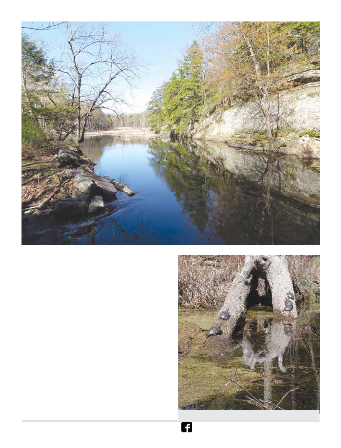
There’s a put-in just south of the 299 Bridge. It takes a while to get out of
earshot of the roar, and this part of the creek is Adirondack-like, with some
longer, wider, straighter stretches, with high rocky banks and tall Hemlocks.
A popular spot for turtles to haul out and bask in the sun.