


 53 / 87

June 2017
53
boatingonthehudson.com
stupid to attempt to deal with it. Many of these are natural
obstacles, tipped off by deep, narrow gorges, and many are
dams. Some dams are relatively low: for example, the Rondout
Creek dam is not very tall, but broad. Others are pretty big,
even huge: the Fishkill Creek has several big dams, the dam in
Wappingers Falls is big, and, hmmmm, think about Croton Dam,
upriver from the Croton River Gorge. I’ve never seen the dam
across the Esopus in Saugerties from below, but it sure looks
scary crossing the 9W bridge, particularly since there seems to
be no orange warning “buoys” above it: yikes....
There are a few creeks/small rivers that we’ve paddled that are
blessedly “un-dammed”. Generally, when we explore these we
paddle until the waterway is no wider than the boat and the
canoe is jammed into the growth on both sides, and we simply
can’t go any further. We then back out until we can find a spot
wide enough to turn the boat around. These, to me, are places
that very fewpeople—except people as nutty as us: like-minded
natural-born explorers—have ever been to before.
One day, while taking the New Paltz Road short cut from 9W to
New Paltz, we saw a sign: BLACK CREEKWatershed; Hudson River
Estuary . We’re always looking for new places to paddle/explore,
and soon brought a boat over and paddled north and south
as far as we could. Whadda find!!! The Black Creek is basically
a small, easy-flowing, meandering (many many “ox bows”/”S
turns”) creek that can be paddled back and forth from several
put-ins. It flows north, and we’ve never canoed to its source, but
on a map it looks to be somewhere in a wetland south of New
Paltz Road, east of Pancake Hollow Road, and west of Illinois
Mountain Park (got that???).
We typically put in at New Paltz Road, and head north, with
the fairly mild current. South, the creek is soon blocked (in a
twisty half-mile or so) by what we call The Big Beaver Dam. We
wrestled the boat over it once, and went a ways further, but it’s
a much bigger Bang For the Buck to simply head north, where
you can get in a couple of hours round-trip paddle. The Black,
as many small creeks, has many many“ox bows”: often it’ll take
something like a mile of paddling to cover a quarter-mile by
the way the crow flies.
The first landmark you’ll hit will be the high stone archway
under the HudsonValley Rail Trail. Then, after about a thousand
S-turns, you’ll hear the roar of traffic on 299 heading to clog up
New Paltz. There’s a put-in just south of the 299 Bridge. It takes
a while to get out of earshot of the roar, and this part of the
creek is Adirondack-like, with some longer, wider, straighter
stretches, with high rocky banks and tall Hemlocks.
You eventually reach a point where the creek takes a pretty
abrupt left turn and narrows dramatically, dropping under a
wooden walking bridge. We once dealt with this short, nasty
little boat-bottom scratcher, but there’s an unnavigable
waterfall a short ways beyond, and it’s not worth the energy
and effort for us to deal with this; this is where we now
typically turn back to the New Paltz Road; ummmm, FYI you’ll
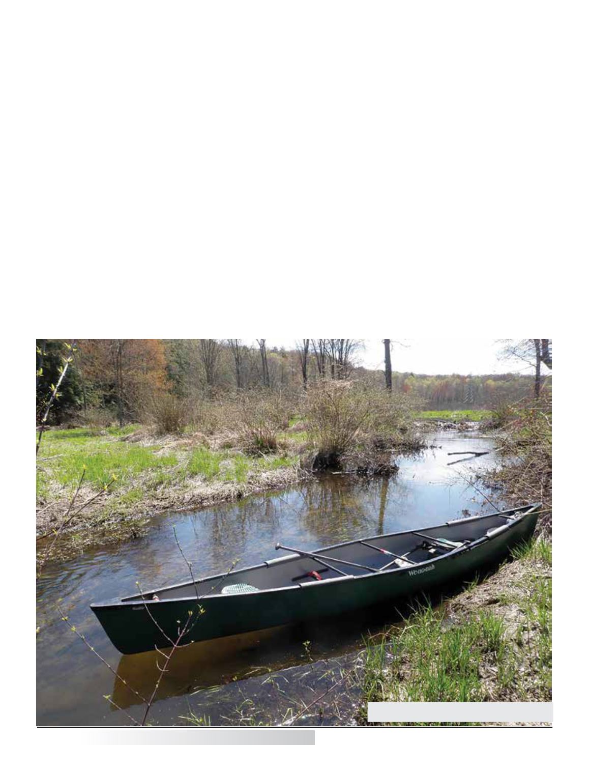
A beautiful spot virtually unreachable by any
means except small “human-powered” craft.